Without too much trouble, I managed to get my Air New Zealand boarding passes and make it through security again here at San Francisco, after waiting a while for the counter to open and then checking my carry-on roller as it was too heavy (first airline I’ve flown with a carry-on weight limit, whoops…least it was free!).
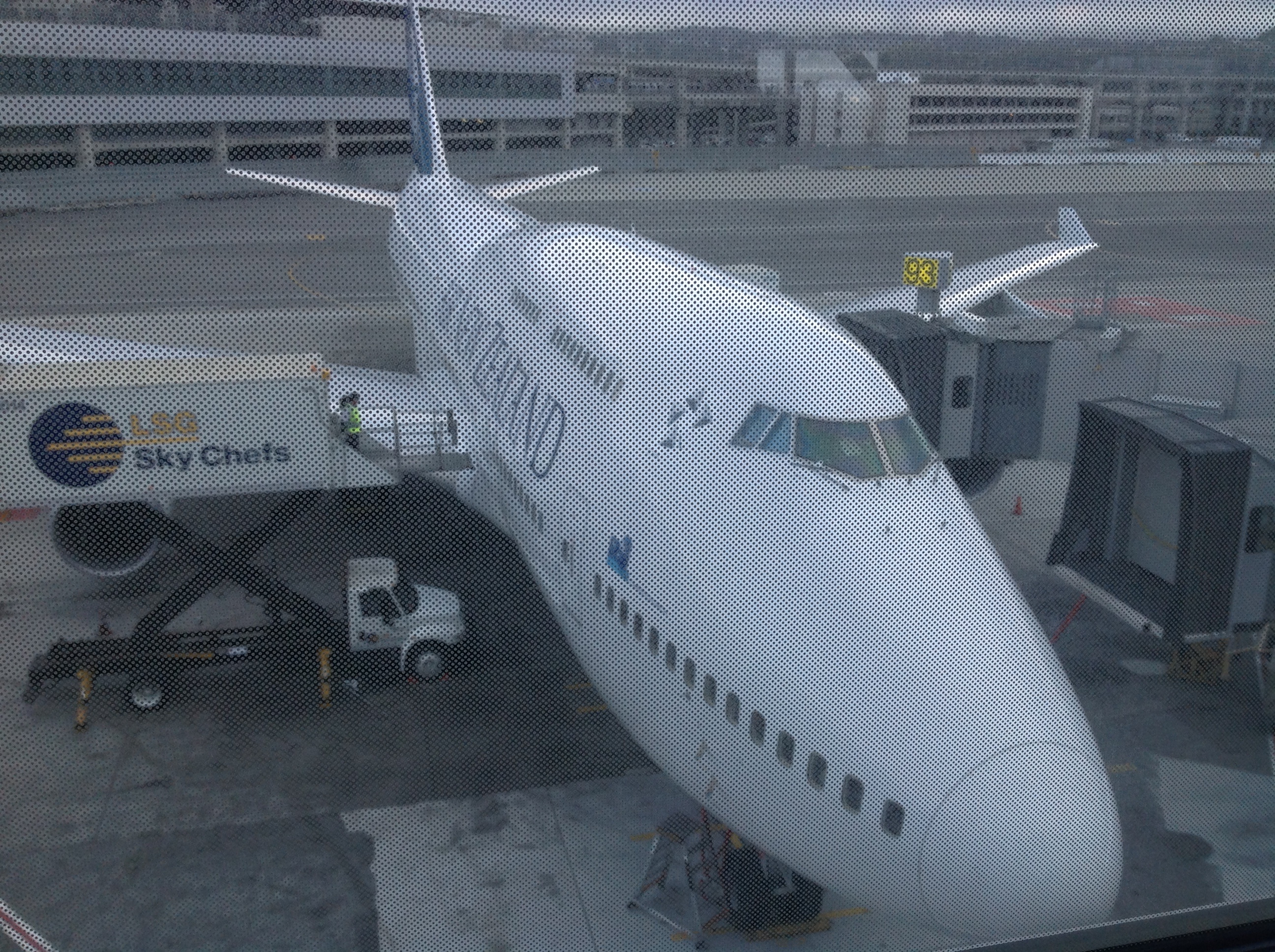
Now waiting at the gate, to board in less than 2 hours. WOW what a big plane, and how thrilling to see it sitting here!
Anticipation is growing, but I think I’ll be tired enough to get some sleep on the 13 hour flight to Auckland. It helps that in Seattle I finally got a neck pillow. After the flight here I wonder how I ever did without one!
Once in Auckland, I’ll go through customs (and get my first NZ stamp in my passport!), possibly pick up my now 4 checked bags to drop off again at the domestic terminal (though the airline says they should be checked through to Wellington, but I’m not certain as sometimes they have to be picked up at customs and I’m not sure how they’ll do it), and make it to my final 1 hour flight to Wellington, my new home. My layover in Auckland is 2 hours, so it’ll go pretty quickly…it’ll be interesting to see how busy customs will be at 6 am local.
It’s starting to sink in…oh what a dream.
Goodbye for now America! Goodbye summer! Goodbye Northern Hemisphere! Goodbye Western Hemisphere! Goodbye US Dollar!
Hello new adventures! New Zealand, HERE I COME!!!!! 😀
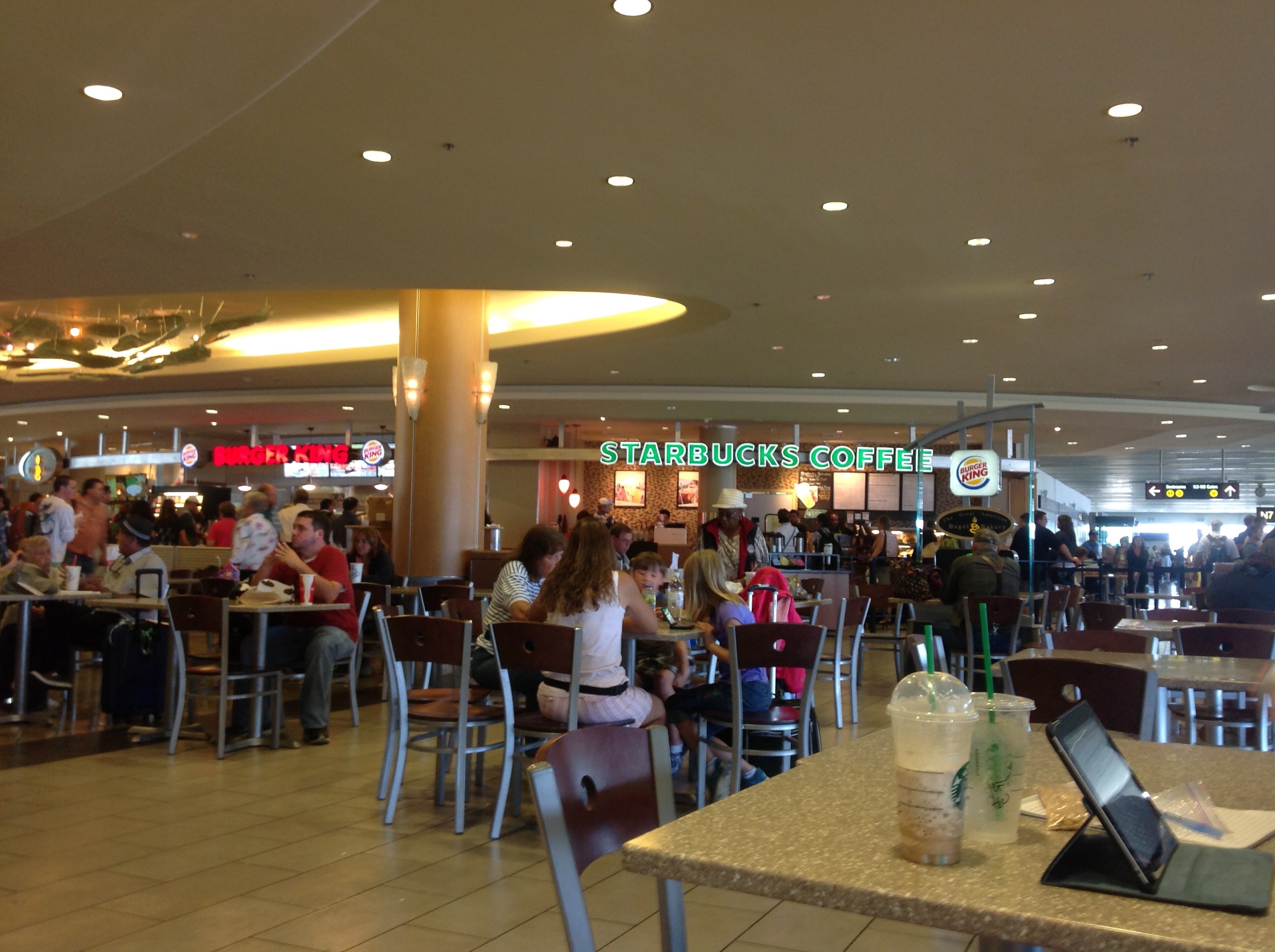
I just can’t go to Seattle without going to Starbucks, in the city where it all began 🙂
After a long wait at the counter to get my bags checked (and a huge blessing via the young man helping me and ultimately getting me Alaska Airline’s $40 fee for my three bags instead of the $350 fee the system wanted to charge me due to connecting with Air New Zealand), I made it quickly and smoothly through security and on to Yakima’s sole gate this morning.
It was only a 25 minute flight to SeaTac (Seattle Tacoma International), so of course it was over before it had barely begun. I was happy to find my gate for my next flight to San Francisco was only a couple of gates down from where I walked across the tarmac and up the steps to my arrival gate.
It seemed pretty busy when I first got here, but things have calmed down a bit since then, allowing me to get my Starbucks hot chocolate and snacks.
Alright, about time to get settled and ready to board flight #2 in about 30 minutes. That’s a short 2-hr flight and then I have a longer layover.
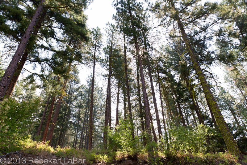
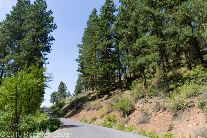
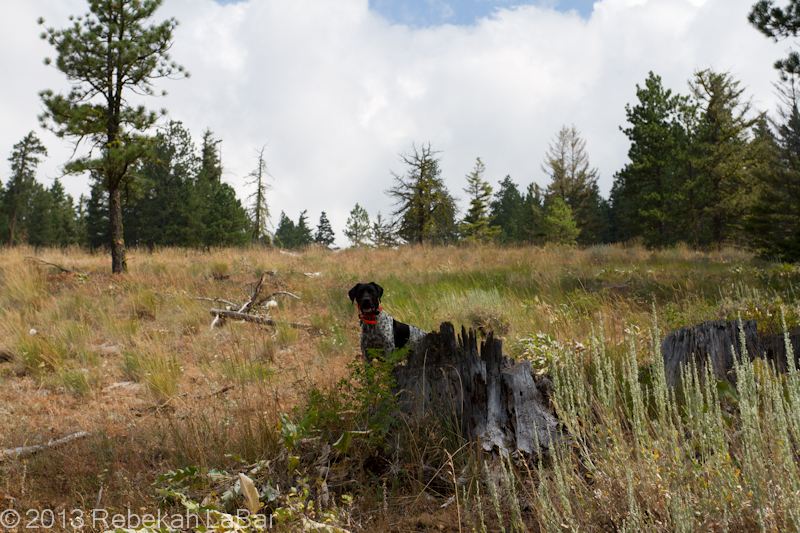
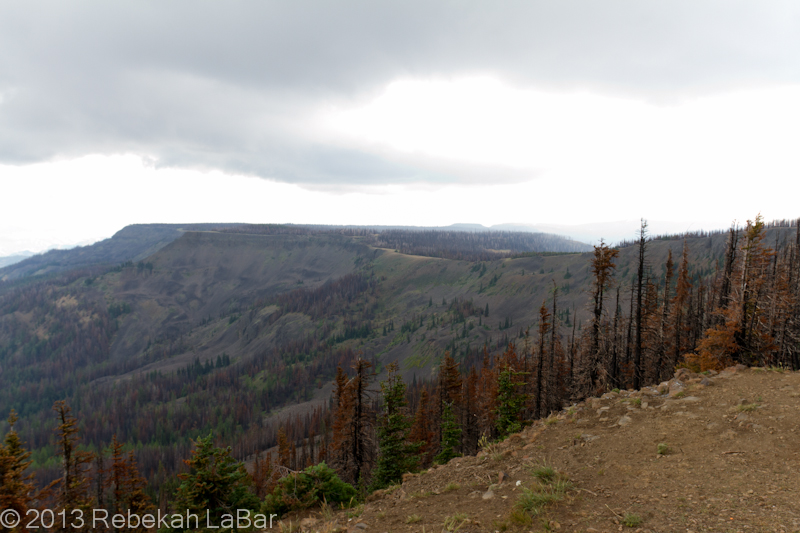
Today was my last (full) day in America for a while. My family and I (including my sister, who drove up last night), went up to Reecer Creek Canyon area in the mountains to see the wildflowers and butterflies.
It was beautiful up there, and I’ll let some of the photos speak more than my descriptions.
This friendly German Pointer, Lexi, found us, and was pointing at every chipmunk and bird she heard! We didn’t see her owners anywhere, and after waiting a while we tried calling the number on her tag. No answer, and finally we had to go, thinking there was a GPS tag on her second collar. Not long after we got a call back saying they found her, which we were very happy about, especially as we were told it wasn’t a GPS tracker but a shock collar. 😛
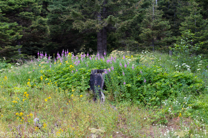
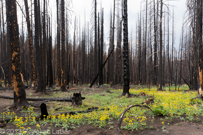
There was a fire in the area last year, and we saw vast stretches of charred trees. However, the grasses and wildflowers were cheerily poking up amidst the devastation, happy for the rejuvenated soil.
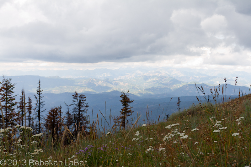
This is Table Mountain (aptly named!), where there is usually a regional star party every August, about the time of the Perseid meteor shower. This year they decided not to have it though, due to some concerns about fire damage in the area and not wanting to disturb the fresh growth.
Mountain Arnica, bright cheery yellow flowers defying a black and white world.
These last few days have been about as busy as the first few, finishing packing and repacking, getting all my affairs in order, and visiting. Last night we had some family friends (including former college mentors) over for a wonderful dinner, and I’m so glad they were able to come as it was great to spend some time with them again.
In the morning I’ll be off to New Zealand. My family will take me to the Yakima airport, where I’ll be glad to drop off my THREE checked bags, and ’twill be a very bittersweet parting.
But after the tears dry, the excitement of travel will kick in again, and I’ll hope to temper my excitement long enough to get some sleep on the long journey. Hopefully I’ll be able to update from the airports.
So long for now, the much anticipated adventure to the Southern Hemisphere is about to begin!!
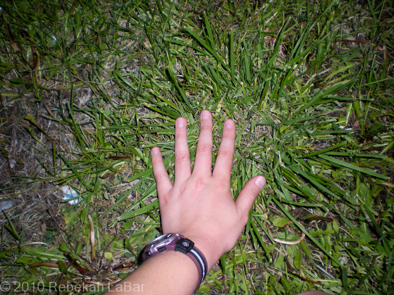
Whenever I go to a new place, I usually have to touch it. And not the hard concrete of a sidewalk or road, but preferably the ground. Preferably with grass.
Strange, I know. When some of my friends and I went up to Nebraska for my first time in 2010, to set up for a storm chase the next day, I ran out of the car (at the first gas station we stopped at inside the state) towards the nearest grassy patch and took a photo of my hand, much to everyone’s amusement. 🙂
I don’t always remember to do it, but I seem to get more excited about the idea of new sights and adventures when I do.
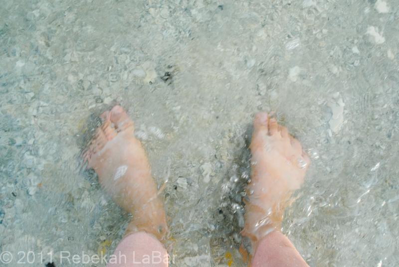
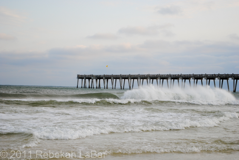
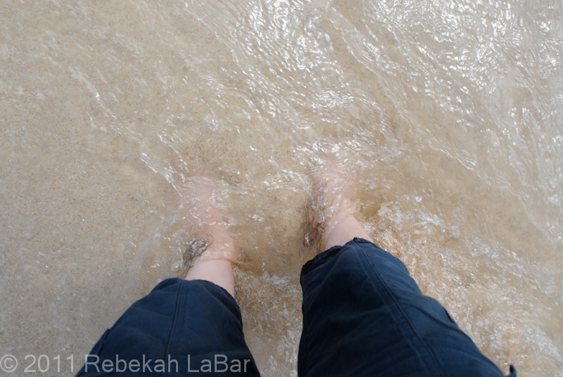
Moreover, whenever I see the sea (at least before I lived on a tiny island surrounded by it for 2 years), I have to dip my feet in it. At least when it’s a new coast I’ve never been to before.
Waters of the Gulf of Mexico, Pensacola, Florida. Not the first time to the Gulf, but first time to the Florida Peninsula Gulf!Just to show part of my ocean view from where I stood at Pensacola…in my opinion, not a bad place for an overnight stop!
On my first day on Kwajalein, when one of my co-workers was showing me around, we stopped briefly at one of the beaches so he could show me the view. I asked if he minded if I ran out to the water for a minute. He didn’t, so I did. I ran out on Camp Hamilton beach and stuck my feet in the tropical Pacific for the first time. Oh the delights of the warm water!
I don’t have a photo of that first ecstatic moment, but I did photograph my first hours on Hawaii, the day before I got to Kwaj for the first time.
First time in Hawaii’s waters, on the first time to Hawaii–at the very crowded Waikiki Beach
You can bet I’ll be dipping my feet in the New Zealand waters (no matter how cold!) at the first decent beach I go to, and surely be touching the ground soon after I’m out of the airport, to be sure it feels the same as ground the world over. 🙂
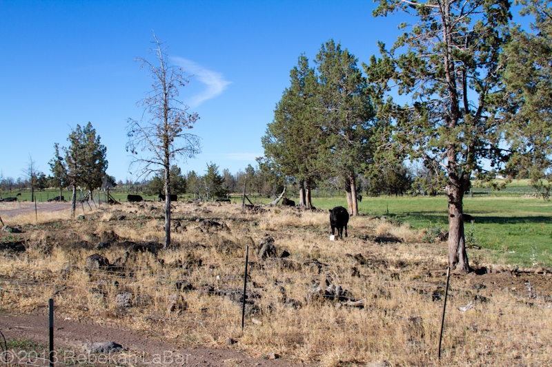
On Saturday my parents and I drove down to visit my grandparents in central Oregon, where my sister met up with us as well. We had to take a longer-than-normal way down, as a wildfire in south central Washington had forced the highway over Satus Pass to be shut down. Sadly the weather in the Northwest has been prime lately for fires, and we saw a fair amount of smoke around on the drive down and back.
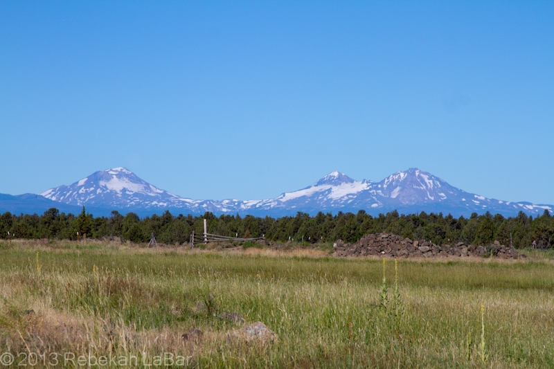
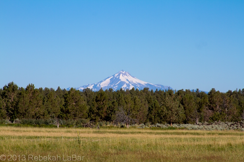
It was a quick overnight trip to the ranch, but good to go down there in the midst of this larger whirlwind trip. Here are a few other photos I took there of the lovely views.
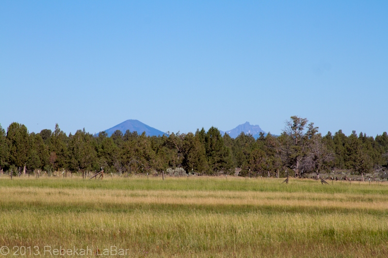
Mt JeffersonBlack Butte (left) and Three Fingered Jack
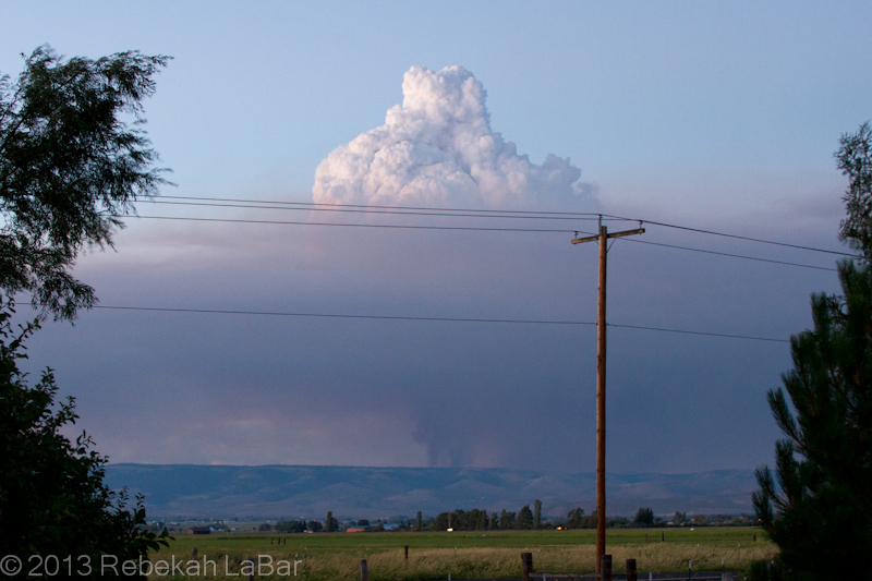
Coming back, as we crested the last ridge before looking down into Kittitas Valley (where my parents live), we got a good look at the smoke from a new fire growing on the opposite ridge.
What I was most fascinated with was the towering pyrocumulus clouds.
Pyrocumulus cloud growing above a smoke column northeast of Ellensburg, Washington
The basic principle behind cloud formation is water vapor condensation onto tiny particles called cloud condensation nuclei (CCN). These CCN could be sand, dust, salt, … or in this case ash.
A fire in effect seeds the atmosphere, and the hot air above the flames can generate rapid and robust convection (rising air) that results in a puffy-looking (cumulus) cloud if there is enough moisture in the air.
Such cumulus clouds that form as a result of fires and volcanoes are known as pyrocumulus, or even pyrocumulonimbus if they grow large enough to produce a heavy shower or thunderstorm.
While the phenomenon is not uncommon, I had rarely seen such a well-defined example. A visible satellite loop from yesterday shows a series of pyrocumulus forming over the fire’s hotspot, and then moving off to the east (due to upper-level winds) as others form over the fire.
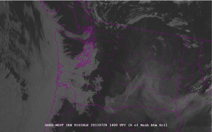
1-km visible satellite loop of Washington State, from 7am to 9pm local (PDT) on 28 July 2013. Counties are outlined in purple. Courtesy of the University of Washington – http://www.atmos.washington.edu/cgi-bin/list.cgi?vis1km.
The fire in the northeast corner of Kittitas County (center of the state) is evident from the eastward-moving smoke plume. Later in the afternoon, about 3pm (2200 UTC), you can start to see the series of whitish knobs forming on top of the fire. These are the pyrocumulus. They really start to explode around 5 to 6pm (0000-0200 UTC).
As an aside you can also see the fire in south central Washington, although there are not so many pronounced pyrocumulus clouds on the smoke plume.
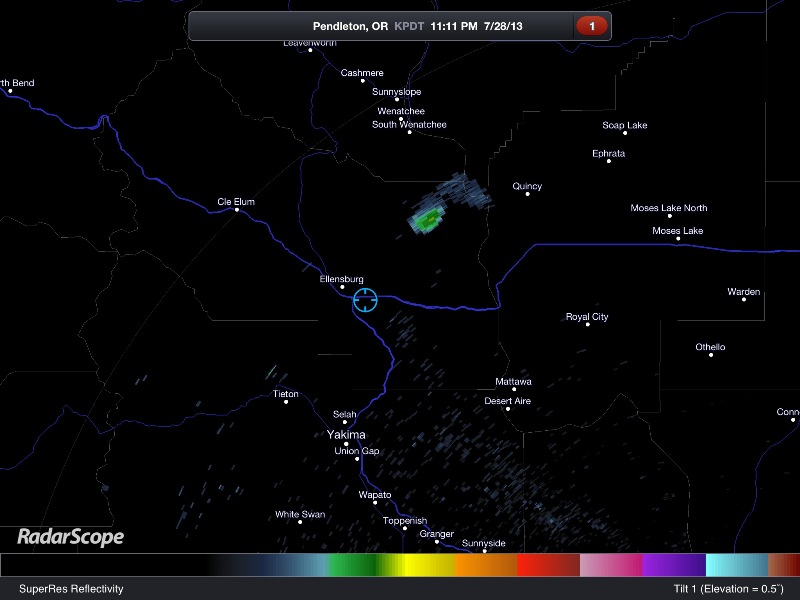
There may have been a little bit of rain falling from the cloud, but a radar loop yesterday showed a stationary spot of reflectivity that was in the location of the fire. Fires are not always visible on radar, but sometimes they are large enough for the ash particles to reflect the radar beam and appear to be stationary “rain” showers.
I didn’t save a loop, but here’s a single image showing the fire last night.
RadarScope image of the Pendleton, Oregon radar reflectivity. The blue circle shows my location, and the greenish blob to my northeast is the fire.
Ok, nerd moment over. For now. 🙂
Here’s hoping the firefighters get some better weather for fighting the fires, and everyone and their homes stay safe.
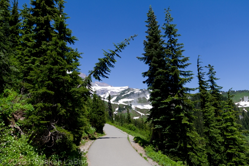
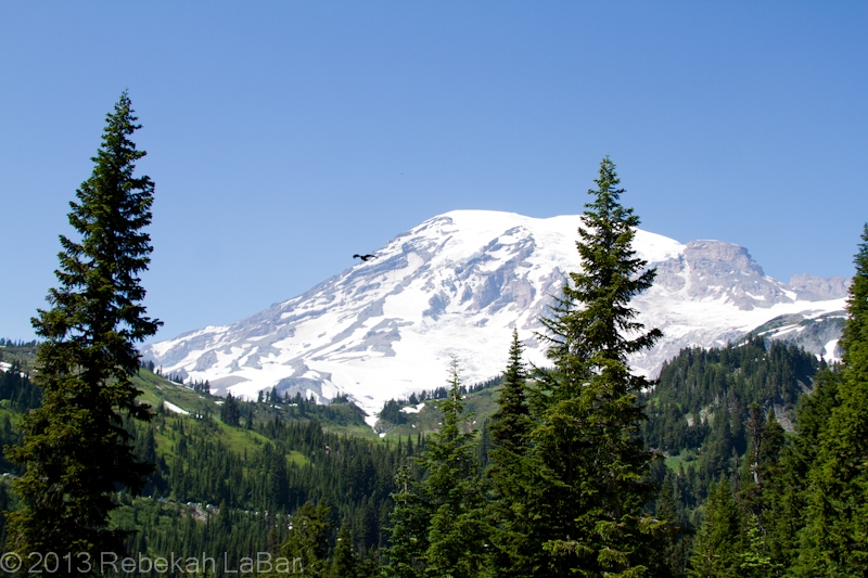
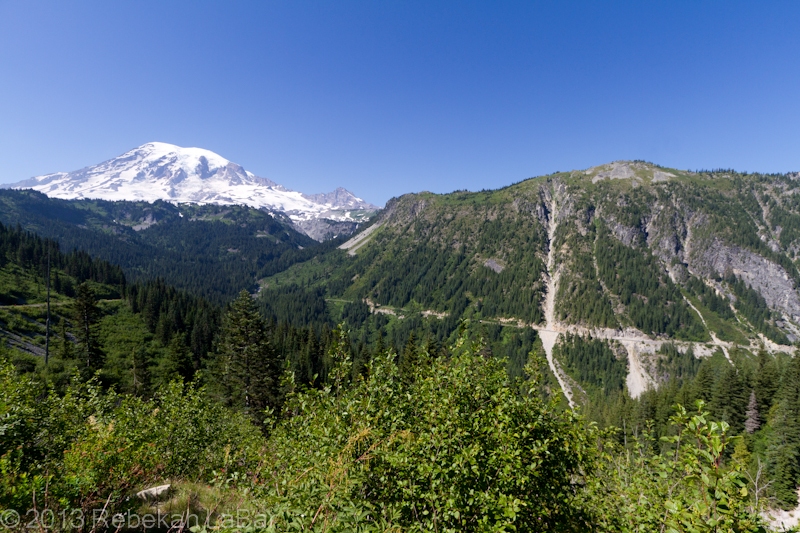
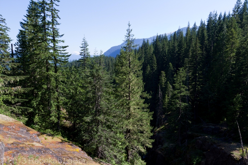
There are two main sites for accessing the base of Mount Rainier in western Washington State: Sunrise, on the northeastern side of the mountain, and Paradise, on the south. I once went to Sunrise about 15 years ago, and that was the last time I had been so close to Washington’s gentle giant.
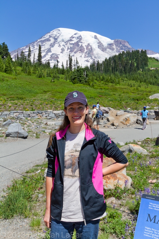
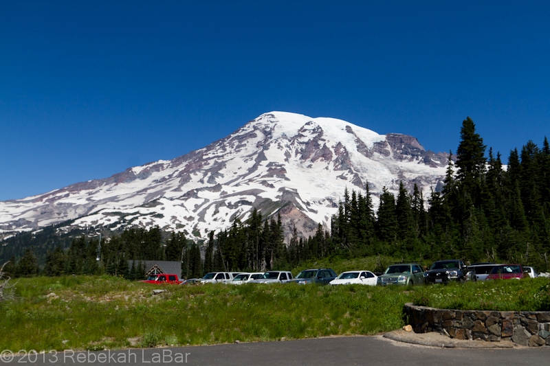
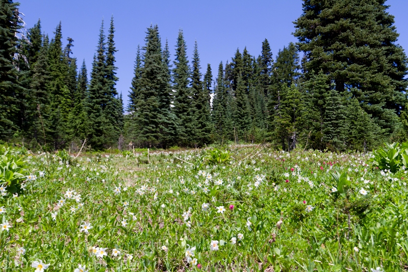
Last Sunday, the 21st, my sister and I met up with our parents near Paradise, and had a wonderful day exploring viewpoints and short walks, the longest of which was an easy walk of less than a mile to a lovely waterfall. It would have been great to do more actual hiking as the weather was fantastic (hot actually) and the wildflowers were in full bloom, but I was recovering from a cold and wasn’t quite up to anything too strenuous just yet.
Tatoosh Range, part of Mt Rainier National Park, at Paradise Inn
After lunch outside the inn, we went on our little walk and saw a few butterflies and myriads of people amidst the beautiful scenery.
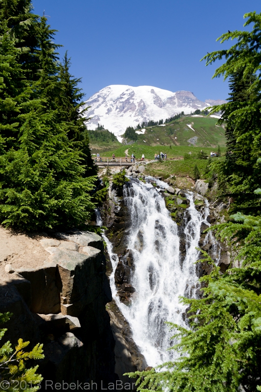
Our destination was Myrtle Falls, a pretty little spot but only accessed from a steep and narrow staircase down from the main trail. The staircase ended on a small platform by the falls which soon became packed with other avid photographers, so we quickly took our shots and left to gaze at the mountain back on the trail.
Even in the midst of a busy day at the park, it was wonderful to breath the fresh mountain air and drink in the views.
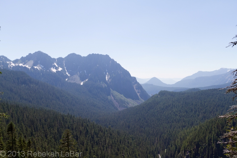
As we left the top of the Paradise road, we drove down and stopped at many of the viewpoints along the way.
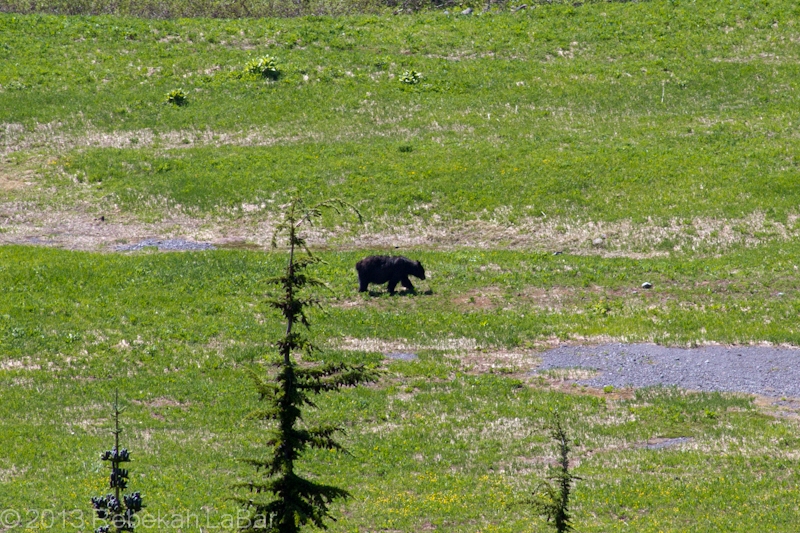
Our second stop was the result of an impromptu, “what are they looking at down in the valley there? It must be an animal…it’s a bear!” from my sister. My sister and I had only ever seen a couple of bears in the wild, and they were young black bears running away from us while we were interning at a wildlife area in the north Washington Cascades about 10 years ago.
This big old shaggy black bear wandered slowly through the valley, eating some shrubs and grass and not bothered with anything. It was a long ways off (can’t wait to get the 70-200mm Canon lens and 2x extender soon), but still pretty cool for us.
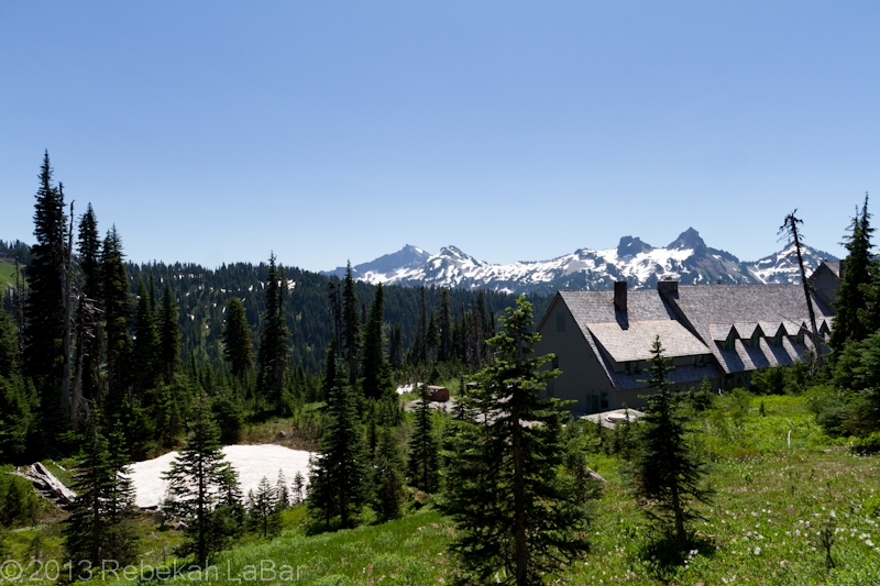
There were a lot of neat spots to stop at, so we took our time coming down the mountain, ooo-ing and aww-ing all the way.
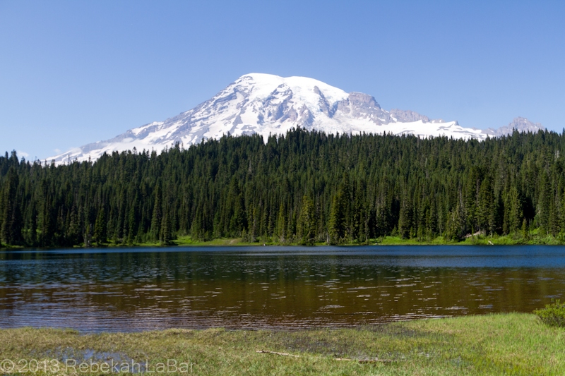
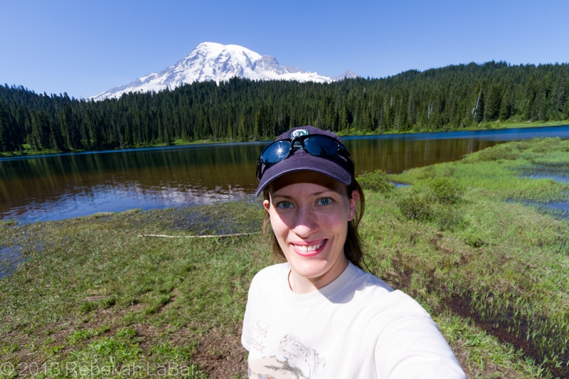
Reflection Lakes
I was particularly interested in the reflection lakes, and trying for shots of Rainier’s reflection as the wind was very light. Sadly the lakes were not quite calm enough for good reflections, but it still was a pleasant stop that involved me being able to finally touch my first snow in about 2.5 years!
At the end of our drive, I moved all my stuff (and myself) to my parents’ car, so my sister could go home and I could go stay with my parents to visit with them (and start the process of sorting and repacking boxes in storage) for a couple weeks.
Mt Rainier and avalanche chutesLooking down towards the Cowlitz River, through the lovely thick forests near Mt Rainier (snow-capped Mt Adams is faintly visible in the background)
Less than NINE days left until I fly off for the long awaited move to New Zealand!! Single digits now, another big countdown.
On Sunday this week my sister and I met up with our parents at Mount Rainier, and the day was stunning. I just drunk in all the thick forests, snow-covered mountains, and meadows abloom with wildflowers. We went on a short walk of about a mile to a waterfall, but didn’t do too much as I was still feeling a little sick (got a sore throat as soon as I stepped foot on US soil, that developed into a bit of a cold but am pretty much back to normal now).
We did stop at a lot of viewpoints and even saw a big old black bear down in a valley! I intended to go through my photos the day after, but have kept busy this week and hope to get to them this weekend so I can share. It was a great time in the mountains, but at the end my sister went home and I left with my parents, to visit with them and get ready for the movers.
That’s what this week has mostly been taken up with; busy, busy, busy preparing for New Zealand. I’ve just about finished going through all my old boxes in storage here from when I moved to Kwajalein, and we finally got the moving date scheduled today, for a week after I leave. I’m sad it couldn’t be any sooner in spite of our hurry to get the estimates once my Kwaj pack out arrived, but happy my parents will be able to take care of it on this end.
I also had time recently for a nice walk around my old alma mater, Central Washington University, where I got my BA in Geography 7 (!) years ago. The day after my graduation ceremony, I hopped in my new car and drove to Oklahoma, as I was that excited to go start my new life there as a meteorology grad student. Ah, the memories. Two of my best friends growing up came to see me, and we enjoyed checking out old haunts and seeing how things had changed around campus.
Now for more visiting and the final last little bit of prep. Got a couple more books about New Zealand that make me even more excited, though I hope this last week with family goes slowly and wonderfully. My Dad says I should just go there instead of reading so much about it…I told him I think I just will. 🙂
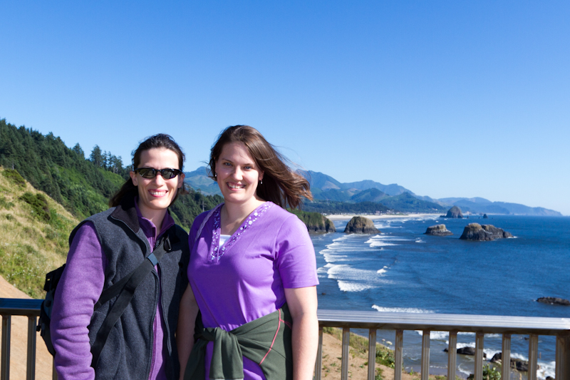
Me and my sister, at Ecola State Park, with Cannon Beach below us
What do people who have been living on a tiny island in the middle of the ocean do when they go on vacation? Go to the beach, of course!
This morning my sister and I (or rather I) laid low as I was nursing a bit of a cold, but then in the afternoon we decided to take the short trip to the coast to see some favorite spots on the north Oregon coast, as well as to finish up the shopping I had started yesterday for cold weather New Zealand clothes.
It was a beautiful blue sky day, and about as pleasant as it gets there on the coast. I was only a bit chilly at times, thanks to my thinned tropical blood, as you can guess from the differences in what my sister and I were wearing. I was also not quite brave enough this time to wade in the water, as many accustomed to the colder waters were doing, especially when I was not quite feeling 100%.
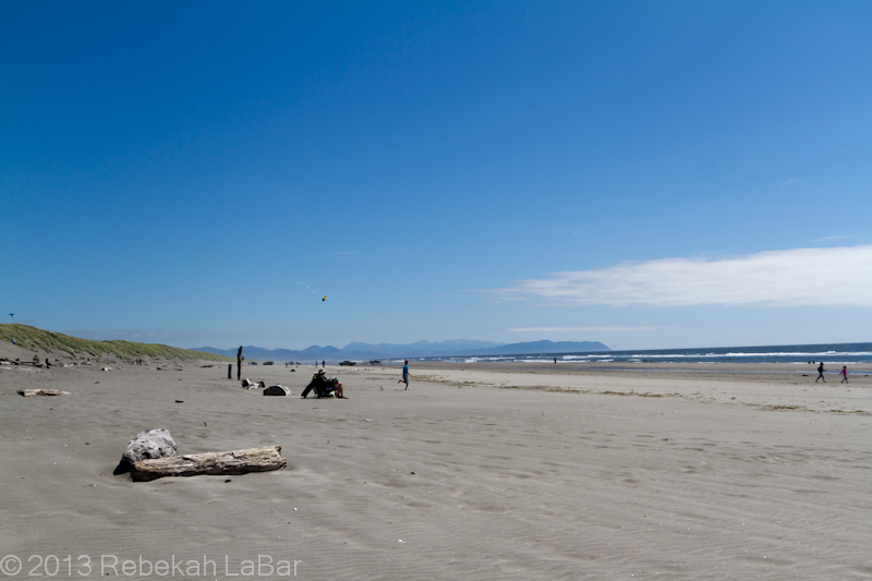
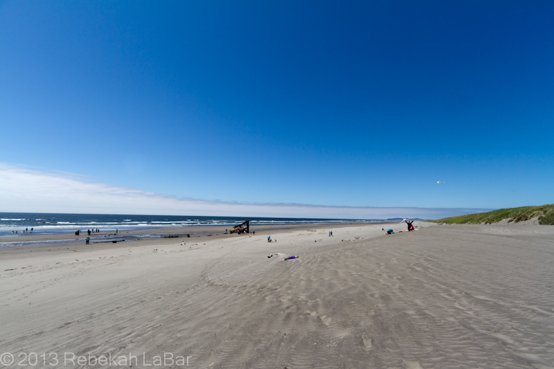
Fort Stevens State Park
One of the places we stopped at was new to me, Fort Stevens State Park. Caitlin had been there before with some friends, but had not seen the shipwreck as exposed as it was today.
Fort Stevens State Park
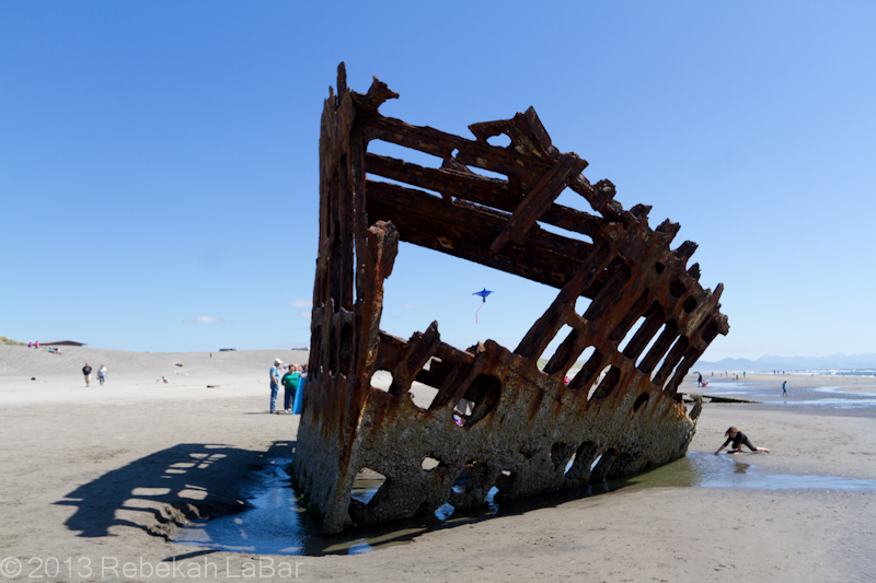
The Peter Iredale was a barque that ran aground while sailing from Mexico to Portland, Oregon late in 1906. Everyone on board survived, but the ship was badly damaged and eventually the remains were left alone.
Bow of the Peter Iredale wreck. It was also a fine day for flying kites!
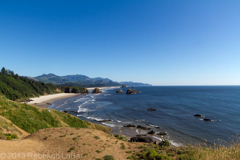
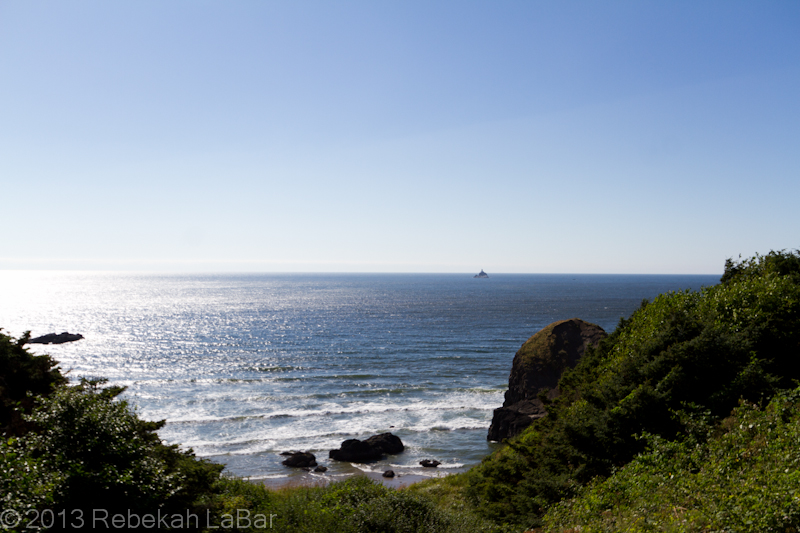
We later drove further south to Ecola State Park, a great lookout point over one of our family’s favorite vacation spots, Cannon Beach.
Cannon Beach with Haystack Rock and the Needles in the distance, from Ecola State Park
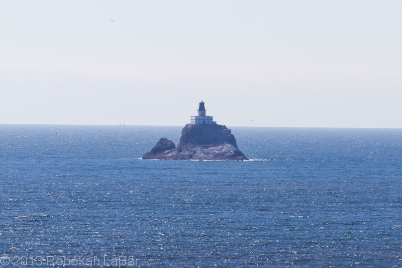
We also had fine viewing conditions from the park out to one of my favorite lighthouses, Tillamook Rock Lighthouse, fondly known as “Terrible Tilly”. I got a book about this light over 10 years ago and was fascinated by its story.
Terrible Tilly
Tilly was built in the late 1800s, on a tiny rock (yes, much smaller than Kwaj…only about an acre, if that!) just over a mile out to sea, and about 20 miles south of the mouth of the Columbia River that separates the states of Oregon and Washington.
After many years of being the most expensive lighthouse to maintain, through many ferocious Pacific storms, Tilly was retired in the 1950s and the private owners converted it to a columbarium (storage for urns with cremated remains). The only way to reach the lighthouse is by helicopter, and sadly it is not open to the public.
Tillamook Rock Lighthouse, from Ecola State Park
It was wonderful to spend even a brief time looking out over the terrific Pacific, especially as I had just come from an island some 5,000 miles southwest of where I stood, and would soon be traveling to another Pacific destination some 7,500 miles or so away.
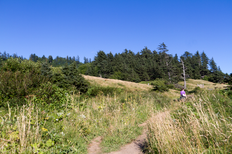
For the first time, though, I was at least initially more taken by views of the forests and mountains, as it’s been so long since seeing good ones of both. My sister teased me that the trees around Ecola State Park that I took a couple photos of before finishing my ocean shots were probably not used to being photographed by most tourists.
Average trees on average hills in Ecola State Park, with Tilly at my back…but still just happy to see forests and elevation!
We’ll probably go check out more forests and/or mountains in the next day or two, but I am glad we were able to see one of my favorite and most frequented spots on the coast. 🙂
For the whole album, including a few more photos from the coast, check out this Flickr set.
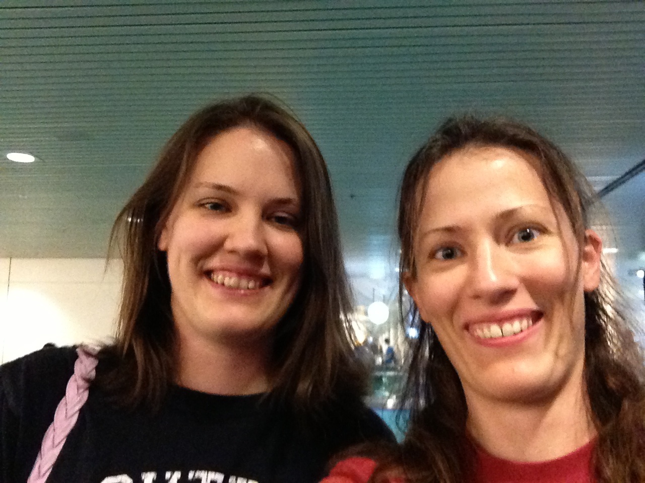
My sis and me, tired, hungry, and a bit bedraggled, but overjoyed to see each other at the airport!
Over 5,000 miles later…I made it!!
Emotions overwhelmed me again as I walked outside to the airplane steps at the Kwajalein airport a couple of days ago. Leaving behind people and places that had meant so much to me (even to the United plane sitting beside my ATI plane, I waved at both sides to a good friend who had just arrived back from vacation), I tried to both soak in the last moments and shut out the feelings of sadness.
Just as I got to the steps it started to sprinkle, and I said aloud, “a fitting farewell for Kwaj” (to which one of the airport workers said “yep!”). The sun then came back out though, for a fine last view of the island. As we taxied down the runway, I saw one of the weather station techs outside getting the 00Z balloon ready to launch, and he waved at my plane, not even knowing if I could see him. I managed to get a window seat on the DC8, so I did see him though, and that made me both happy and sad again.
When the plane turned around and kicked it into high gear, I couldn’t help the tears streaming down. I cried until I could no longer see the island (which was a bit longer than you might think, as I craned my neck back for so long it hurt), and then settled back with a sigh to watch the rest of the islands of Kwajalein Atoll disappear into the blue of the sea and the sky.
The flight to Hickam (air force base at Pearl Harbor in Honolulu) was uneventful and seemed to go by fairly quickly. At the baggage claim I said a quick goodbye to a couple of Kwaj friends and shared a taxi to the Ala Moana Hotel.
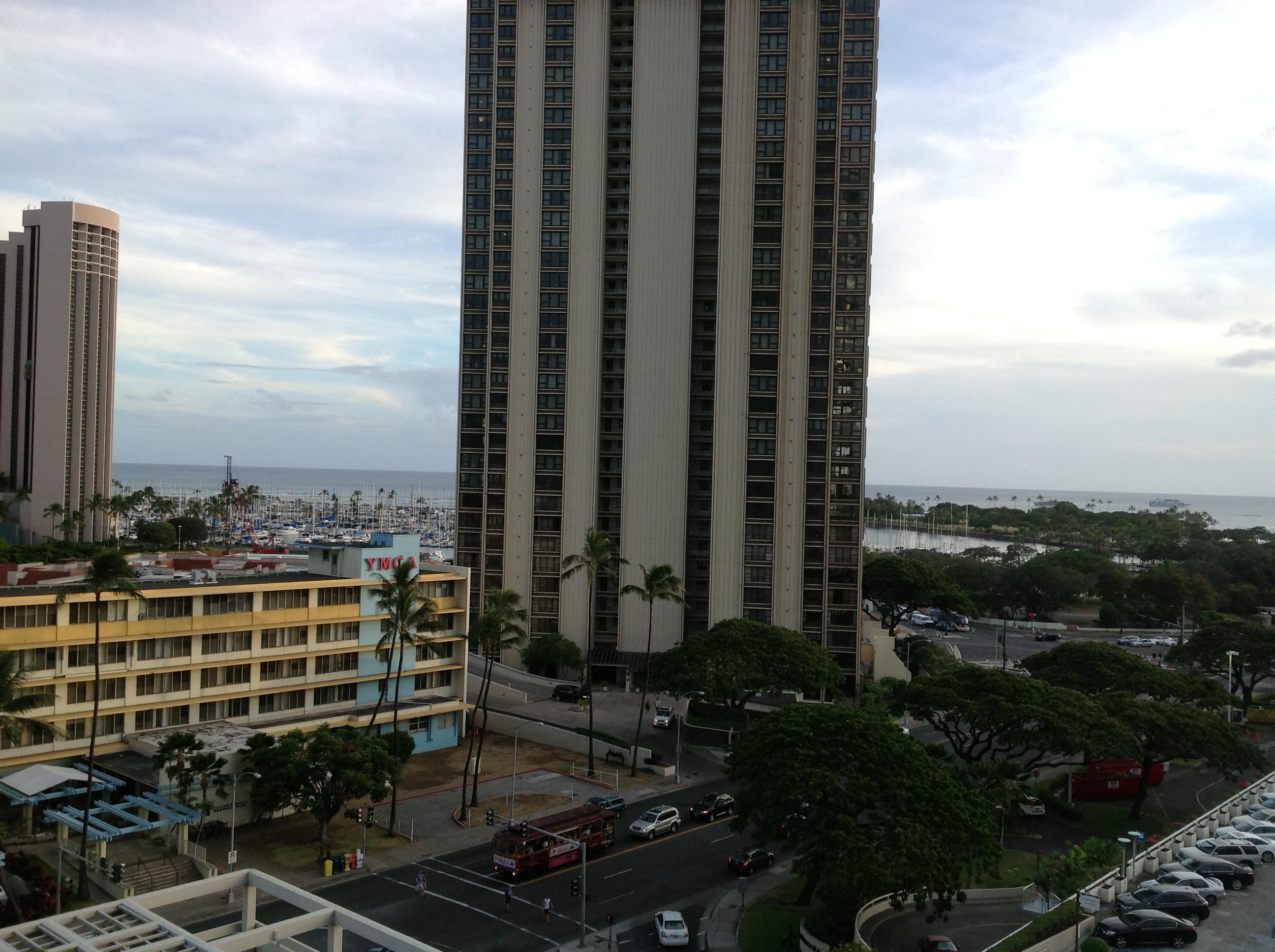
Part of the view from my 9th floor balcony
This time even with three large bags (quite hard for me to deal with, but doable) and a backpack, I somehow managed to make it up the elevator and to my room on the first try (might have something to do with someone else inserting their key card and then me pushing my button after his).
The other part of the view from my balcony
After settling in a bit, I walked over to the mall across the street for dinner. Every time I leave Kwaj I feel a bit overwhelmed at first by the traffic and “civilization”. One of the first sights to greet my eye was a trolley full of Asians with the driver leading in a hearty rendition of “YMCA” (maybe having something to do with the tour group just having passed the Y. They all looked so happy I couldn’t help smiling and waving back.
I got a good night of sleep and was up at a decent hour for breakfast before taking a shuttle to the airport.
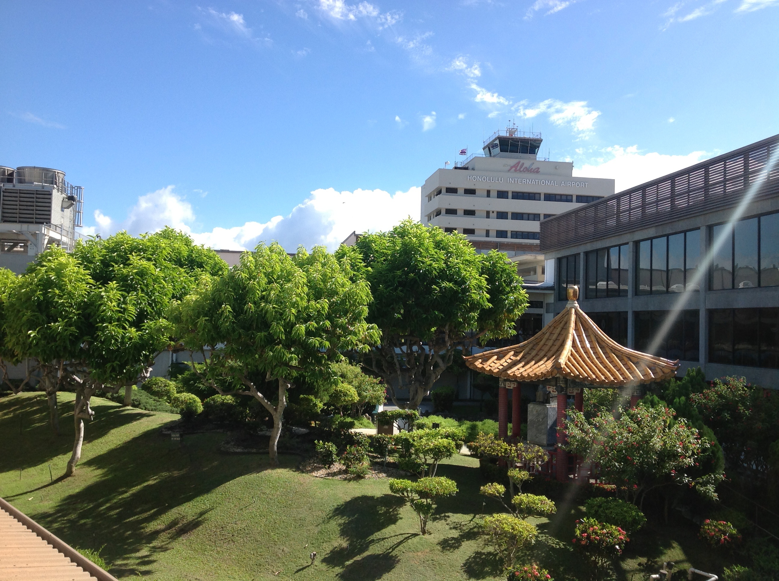
Open breezeway at HNL
I had a direct flight to Portland that was only a few minutes longer than my flight the previous day to Hickam, but somehow it felt an hour or so longer (perhaps having something to do with it being a crowded commercial flight instead of 15 people on a private carrier being treated nearly like first class).
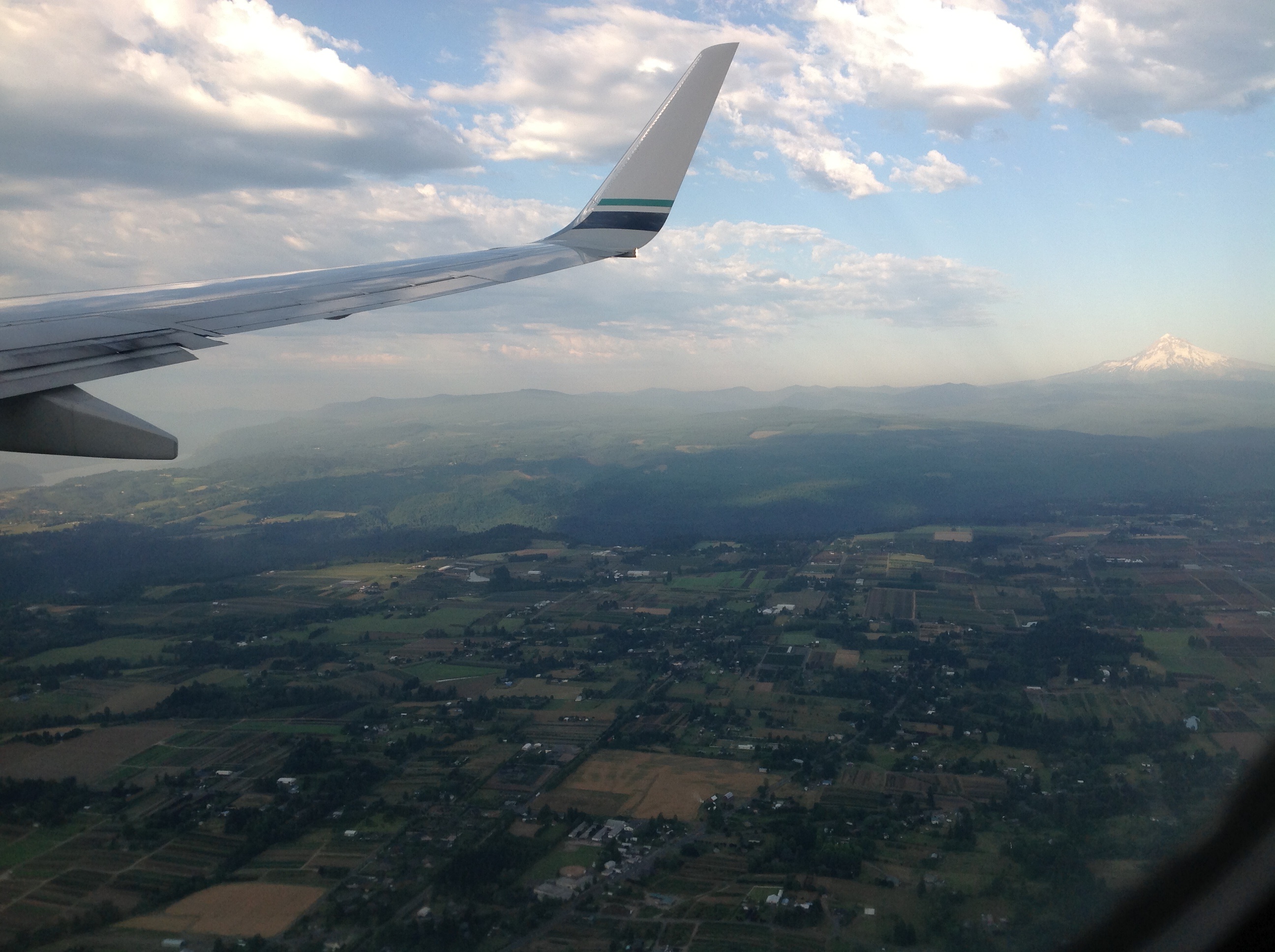
Approaching PDX (Columbia River on the left, Mount Hood on the right)
My first glimpse of land was dramatic; coming out of the clouds, I saw forests of dark green Oregon conifers, and I thought I’d rarely seen a more beautiful sight. Barring the dying Black Hills of South Dakota (forests turned to brown and orange thanks to the pine beetles) that I saw a couple months ago while storm chasing, I hadn’t seen evergreen forests in two years.
I saw pasturelands next, against the beautiful backdrop of the Cascade Mountains, with Jefferson and Hood being most prominent.
Next came cities and the Willamette River, running down to the Mighty Columbia, with my home state of Washington on the other side. I also then saw Mount Adams and St Helens.
At this point the journey ended almost as emotional as it had begun. After two years, my reunion with the Pacific Northwest was a wonderful one, and I laughed and shed a few more tears of joy and yet still sadness for the life I had left behind on a tiny rock in the middle of the Pacific.
My sister and I were then happily reunited at the Portland airport, and after we got my bags and went to dinner, we made it safely back to her home in Kelso (southwest Washington).
May the next 2.5 weeks of visiting family and friends, sightseeing, and shopping and preparing for my New Zealand adventure go slowly and fantastically!
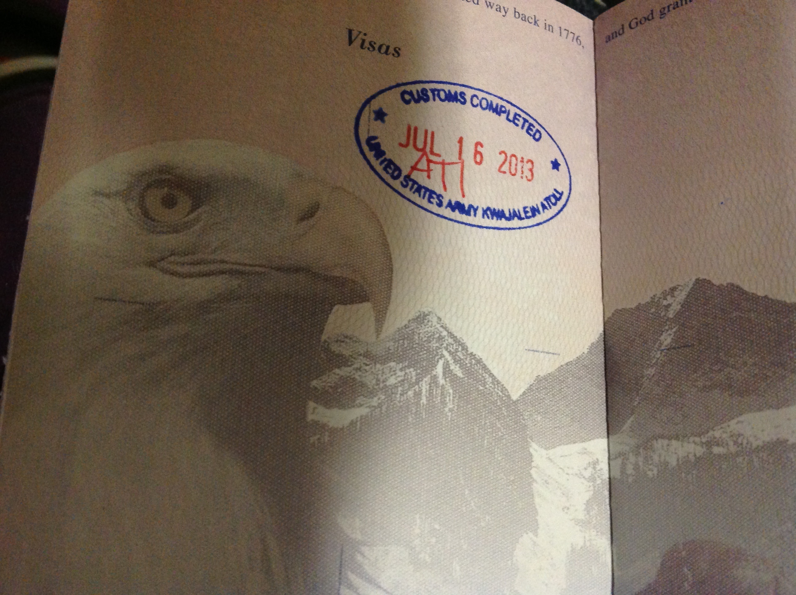
It took me two years to earn it (or rather to find that a passport stamp existed for Kwaj), but earn it I did! Until we meet again!
Said my final goodbyes this morning, and now sitting in the Kwaj terminal waiting to board the direct flight to Honolulu before long. It’s about a 5 hour flight, and I got my window seat!
While I have mixed feelings about leaving, after being sentimental last night I am back in the mindset of being ready to move forward. I can’t wait to see my family again, and hope the next three weeks will go slowly and be very enjoyable…as THREE WEEKS FROM TODAY, I WILL BE IN NEW ZEALAND!!!!